
Kayak Camping: Whidbey West
2025 Feb 10Last December I phoned a kayaking friend. Michael is very knowledgeable about camping equipment, and I was looking for some advice. This turned into a conversation that we should do a winter kayak camping trip.
His preference was to go to the Washington coast. It is rare, however, for ocean swells to be mild during the winter. It looked like there might be a calm window that would be perfect for both swells and weather, however, the situation changed so we went to a plan B.
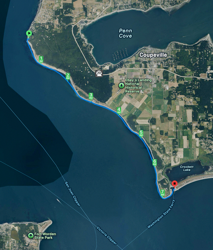
Michael had never kayaked along the west side of Whidbey Island, so we planned a trip from Anacortes to Fort Casey. He invited a couple other guys, noting that anyone who would go camping in the winter is probably somebody you would like to spend the time with. This was during our recent cold snap, so it was not a surprise that in the end they declined.
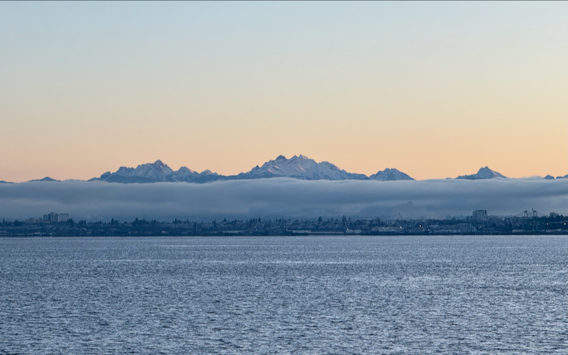
So the two of us met for the ferry to Whidbey Island in the morning and drove straight on with no wait. The sun rose while we were on the ferry, painting the mountains in a lovely warm glow. The weather, however, remained very brisk.
On Whidbey, we would then ferry our boats. This meant that we left a car at our Casey end-point, and put both boats on the other car to travel to our start point (at Washington Park). To mitigate the chilly weather, we had several bundles of wood which we stashed at our camping locations. Finally, we packed our gear in our boats and launched.
Day 1
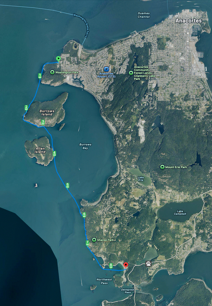
At a small rocky beach on Burrows Island (before mi 3), we stopped for a shore break and food. It was in the sunshine and out of the wind. After I added a layer over my dry suit and PFD (flotation) it was comfortable.
The water was edged with a rock face at miles 6 & 7. We found at least four caves big enough to enter. There was an otter in one of them that swam under us and was running around on rocks at the back of the cave. The tide was different than last time we were here, so I’m not sure which cave was the one we boated into then.
At Deception Pass, the Cascadia Marine Trail campsite has picnic tables but no fire ring, so we walked over to one of the Bowman Bay Civilian Conservation Corps picnic shelters. It was enclosed on three sides, had a fireplace and even power for lights. We ate our dinner as the fire warmed the area. With a good supply of wood, we were there more than three hours before the fire was done.
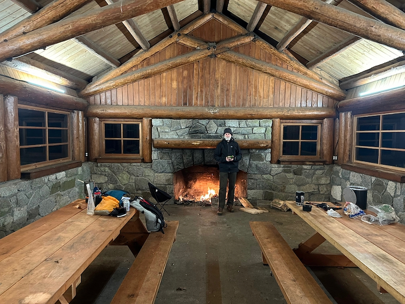
Sometime in the evening a ranger walked in wearing a full tactical vest bristling with equipment. He asked us very seriously what our plans were for the evening. (There is no regular camping at Bowman Bay during this season.) When we explained we were at the CMT site, he relaxed completely and just asked us to turn out the lights when we were done.
When we were first setting up camp and Michael saw my Hilleberg tent, he said he had a problem with their tents! The problem was that he bought too many of them! :-) (Of course, his tent was a Hilleberg as well.) Although this was probably the coldest evening, in bed it was perfect.
Day 2
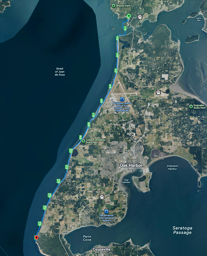
This was our longest day. However, the currents were in our favor and the breeze at our back all day, so it was not a hard paddle.
The beach along the airfield of Whidbey Island Naval Air Station was not guarded. We did see a couple of people out for a run.
Our lunch stop was Joseph Whidbey State Park. There was a picnic shelter where we ate lunch. Later we realized our stop had actually been Rocky Point Beach and not the Park. (Oh well.)
After lunch we saw several Harbor Porpoises about a hundred yards off, surfacing several times to spout as they travelled. (They seemed so small.) Then later there were humpback whales farther out in the Sound. We saw plenty of spouting, saw some backs, and finally the flukes as one dove. (My first time seeing whales from my kayak!)
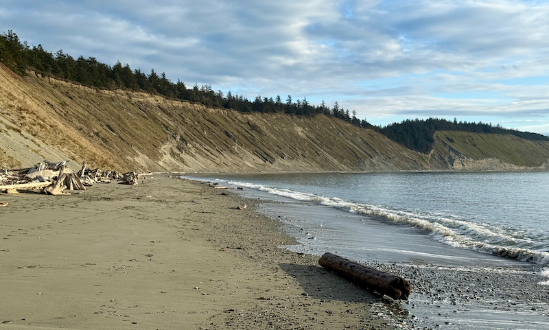
The general characteristics of Whidbey along this trip was high eroding sandstone bluffs with occasional low-land sections. The horizontal sedimentary banding was interesting. At one place the top of the bluff looked like a grand castle battlement, as if it was man-made. From the top down, it had a thin dirt layer, a twenty foot vertical wall section (the castle), then the rest to the beach was an eroding angled sandy section.
We stopped for a final short shore break along one of these bluffs, but then got quickly back in the boats before getting cold.
Arrival at Ebey: Our campsite was at the only spot in the Park that was not a high bluff, right by the beach.
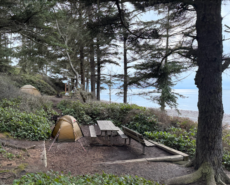
As we set up camp there was some light spitting rain. We considered eating at a picnic shelter, however, it was a distance away and the fire wouldn’t have been convenient. (A grill, not a fire pit.) So we stayed at camp, and it was the right choice.
The fire and the evening conversation were great. Michael decided to augment the wood we brought with excess from the beach. After warming and drying, it burned nicely. Didn’t stay up as late as the previous night.
Day 3
Our last segment was short like the first day. At Perrigo Lagoon (mi 2.6) there was an eagle perched on some standing driftwood, ignoring us as we went by. We took a quick shore break to look over the lagoon. I thought the hike on the ridge above looked interesting. •••
I went back a few weekends later and did this hike - from Bluff Head to Perigo Lagoon and back. Recommended!
This whole trip had been a very zen-like kayaking experience - chilly, chill and calm. At one point we joked about dealing with 3-inch chop! •••
More details:
- Checking out the campsites ahead of time: Ebey was a surprise because the road in was ice and snow. Glad we were in the AWD. Water available in the bathrooms. Stashed the firewood.
- Next stop at Bowman Bay, we stashed the remainder firewood behind a CCC shelter. Again water.
- Lots of bull kelp along this trip, but it often didn’t look healthy. Many were missing all their trailing “hair”, or had other stuff growing on them.
- Places on land that we passed which was in the shade often still had snow on the ground. At camp, sections of the beach in among the driftwood was still white.
- Deception in the morning: Lots of kayakers pulled into the parking lot. There was a Mountaineers group going for training in the Pass. There also were other kayakers independently there.
- Lunch 2nd day: Put the cagoule on while eating, but then kept it on when back in the kayak. That was about right for temperature. First time using it while on the boat.
- (The picture of the bluffs was from when I hiked Bluff Head later.)
- Ebey camp: There was a blinking light on a metal frame on the hill above us - a "lighthouse".
- Across the water out west during this trip were the San Juan Islands, then the Strait of San Juan de Fuca (clouded in the distance), and finally the Olympic Pennisula.
- For much of the trip there was an island in the distance (Smith Island) that seemed to be floating above the water. A mirage effect. Ocean-going ships that passed were similarly affected.
Rounding the point at Casey a group of six sea lions popped up close to me, all with huge heads. They kept pace for a while about 20 ft behind me in a tight group, all watching intently and chuffing forcefully as they breathed. Then just as suddenly, they all disappeared under the water. A bit of a relief; they must have just been curious.
We arrived just as the ferry was departing. It made a long blast, so (of course) we waited for it to pass. The boats were unpacked, put on the waiting car, and we started up the island. At the other car we transferred stuff and then parted, looking to do another trip again soon.
- See also the 2025 kayak trip list.