Kayak Camping: Shaw, Lopez, James Islands
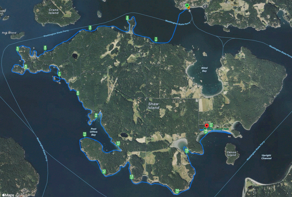
2024 Apr 21

My general plan was to do a circumnavigation of Shaw Island. I had three days for camping, but Shaw would not take that long so I included a spur out to Lopez Island. I walked onto the early ferry from Anacortes to Orcas Island, pulling my wheeled boat.

The first day’s route ended at Shaw Island County Park:

track around Shaw Island

The view of the Olympic Mountains from the campground.

mountains in sunset through island gap

It was unusually warm weather for April. The parks reservation system doesn’t open until May however, and kids are still in school, so even with the good weather very few people were out camping. This first night I was the only one at the campground (and subsequent nights I saw hardly anybody in the evening either).


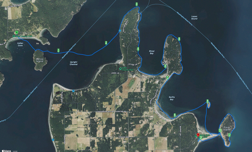
The second day’s route to Spencer Spit State Park:

track from Shaw around north of Lopez to the Spit

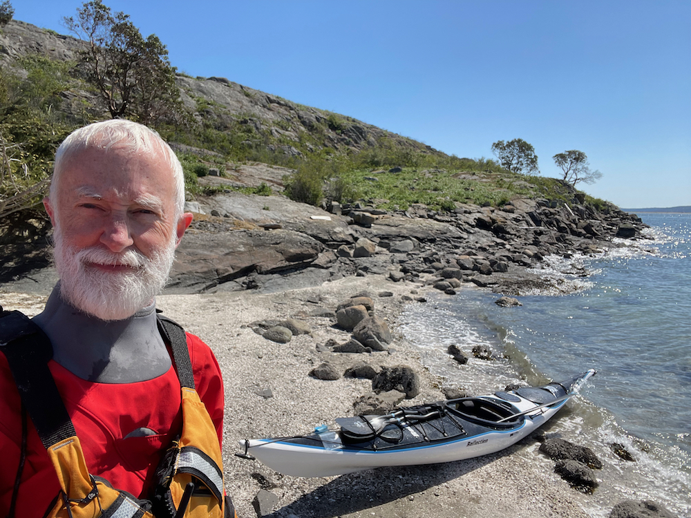
Stopped off at a small island along the way (mi 9).

selfy at island beach with kayak

The view from my campsite at Spencer Spit was the best in the whole park.

Spit with Frost Island and water

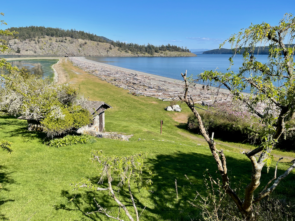
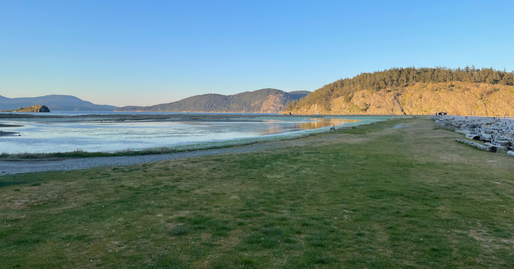
At the base of the spit looking northeast.

grassy Spit overlooking marsh and islands

The advantage of doing kayak camping near a Washington State Ferry route is you get excellent cell phone service. All during this trip the service was better than I get at work. It allowed me to keep the family up-to-date with my status.

I realized at this point that I was already partway back to Anacortes, so I changed plans to continue that direction to James Island State Park.


The third day's route to James Island:

through Thatcher Pass to James

Each day so far I had been doing a shorter distance. This day I pulled into headwinds for the whole distance and so it still required good effort. I was properly tired at the end.

When tidal currents meet they create a confused busy surface on the water. The intersection is called an eddy line. There was one from James Island back to Thatcher Pass from the current flooding north around James. Sometimes these sound like a brook flowing over rocks (or louder). It is wise to be careful around them because they can indicate sudden shifts in water flow. However, the currents in this area were somewhat slow so I went right through them - busy and delightful.

There also were gusts of wind blowing across the water. You can watch them approach because they scrape at the water surface, making it rough. It is so interesting to be in a lull and watch the gust approach and hit you in the face.

The wind had dried the day's salt spray to white crystals all over my dry suit.

At James Island, there was only one other person (in by powerboat). A jug of milk and another of orange juice had gotten away from him down the bay. My small boat was able to go near the rocks where they were floating, so I retrieved them for him. (At least they had become refrigerated in the sea water. :-)

My campsite was up a steep hill. I was carrying the last load of camp equipment up when a private island ferry went by at a pretty good clip. (I thought I had lifted the boat well enough beyond the waterline and so I had left the hatches open.) Hearing the sound of breaking waves on the beach, I looked down to see my boat being carried out into the water. Dropping my load I ran down the stairs, into the surf and caught the boat. I was still in my dry suit, so I wasn’t inconvenienced, but it was a startling lesson.

So, I brought my boat up to the campsite. Then only a tsunami could carry it away!

boat, tent and supplies in clearing

I had more time this day, so I explored the island’s trails.

pine needle covered trail through evergreen trees

There was a great sunset.

sunset over Decatur Island

It rained that evening and a big wind came through, so I spent a lot of time in the tent. In the morning it started raining again just as I was getting my stuff out of the tent to air. So, plan B: everything back in the tent, pack it in the dry bags and put on the drysuit.


The last day’s route to the Anacortes ferry terminal:

Across Rosario Strait around Burrows Island and to Anacortes

The current was ebbing south, so I let it take me to Burrows Island and stopped there to look at the historic lighthouse. Continuing down around the island at the time of tide change, I was expecting it to start pushing north. Then, in the channel between Burrows and Allan Islands I could hear an eddy out in the middle. The leading edge of the incoming flood was making a lively choppy push. I joined it (mi 5.4) and it made for great surfing. Twice I actually zoomed out in front of it, so paddled in reverse until I was once more in the middle of the melee and surfed forward.

There were a few more places I was able to surf. On the west side of Washington Park (mi 9) I was moving so fast that it felt like I was on a bicycle. Exhilarating!

Finally at the beach by the ferry terminal I unpacked the boat so everything could be carried up to the sidewalk. Putting it on wheels once again, I walked it around to where I had parked the car. Overheard a passing comment about my vehicle in tow from one of the toll booth people, "You don't see that every day."


Other memories:

  • The continuously textured rocks of the islands with life attached both above and below the water. Evergreen and madrone (arbutus) trees. The color of spring flowers some places.
  • The bull kelp seemed more sparse than before and didn't look very healthy.
  • Harbor seals were very wary of me. If they were hauled out on one of the many little islands, they would all dive into the water while I was still a long way off. One group stayed around afterwards and I counted six curious heads watching from behind. One was in front, close. When I turned my head to him, he ducked under the water and I saw his body swooshing under me between the boat and the rocks.
  • After leaving Shaw I saw a sea lion lazing on his side, occasionally waving a large flipper up out of the water. I steered around him and I don’t think he even knew I went by. (I can be very quiet with my straight stick paddle. A couple of times a surfacing seal or otter was surprised to see me when they looked my direction, diving suddenly with a splash.)
  • I looped around a small group of rock islands. On them there were big groups of gulls, cormorants, seals, some Canada geese, and one eagle tearing at a meal.
  • Two raptors soaring above the ridge of an island in the uplift from the prevailing wind - just floating on air, the outline and color texture of their feathers visible from beneath.
  • Also: otters, sea stars.
  • At camp: a cluster of small iridescently blue butterflies, bursting up from the grass and fluttering, glittering all around me.
  • The sweet fragrance of spring flowers.
  • The smell of the evergreen forest on James Island enhanced by fragrance of newly dampening earth.
  • A raven chuckling above me that also made a sound like a phone musical alarm.
  • Sitting in the grass on the south side of James Island, feeling the breezes, looking out at the expanse of Rosario Street, watching the clouds, the weather, eddy lines from currents and patterns on the water.
grass, water and clouds